|
Attribution forecast for February 2015
|
|
|
Attribution to greenhouse gas emissions
|
| These maps show what we can say with some confidence about how the chances of an unusual February 2015 have been changed because of our greenhouse gas emissions. More details are given below the maps. |
|
|
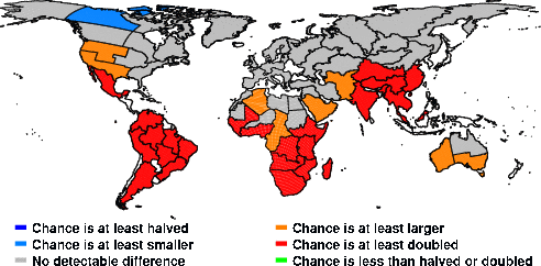
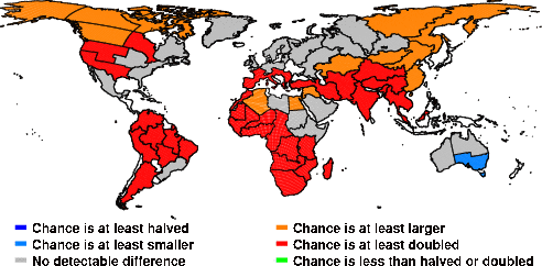
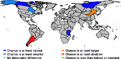
Hot events over regions around the globe
|
|
A February which is at least as hot as the 5th hottest February over the 1960-2014 period.
|
| HadAM3P-N96 forecast model (?) |
HadAM3-N48 forecast model (?) |
 |
 |
|
|
|
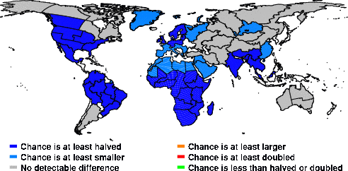
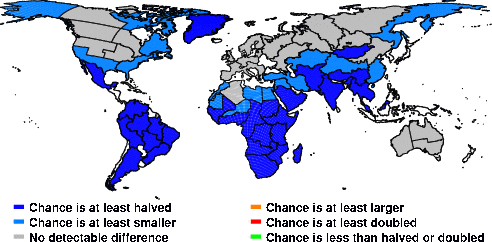
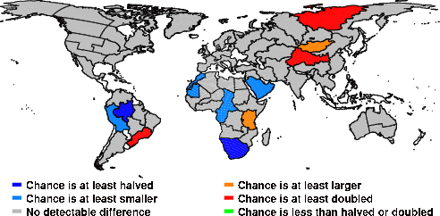
Cold events over regions around the globe
|
|
A February which is at least as cold as the 5th coldest February over the 1960-2014 period.
|
| HadAM3P-N96 forecast model (?) |
HadAM3-N48 forecast model (?) |
 |
 |
|
|
|
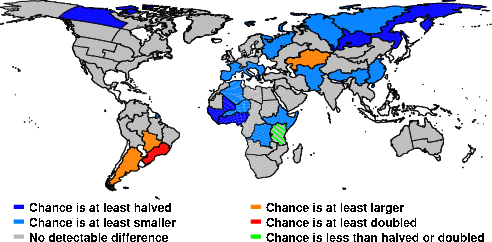
Wet events over regions around the globe
|
|
A February which is at least as wet as the 5th wettest February over the 1960-2014 period.
|
| HadAM3P-N96 forecast model (?) |
HadAM3-N48 forecast model (?) |
 |
 |
|
|
|
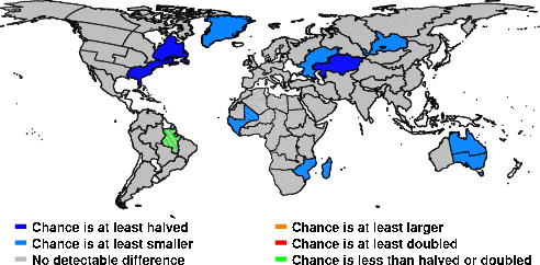
Dry events over regions around the globe
|
|
A February which is at least as dry as the 5th driest February over the 1960-2014 period.
|
| HadAM3P-N96 forecast model (?) |
HadAM3-N48 forecast model (?) |
 |
 |
|
|
These are not the most probable contributions of our emissions but rather a statement of whether that contribution has passed a certain threshold, in particular whether they have at least changed the odds or at least doubled/halved the odds. So if the "odds are at least doubled" then the chance has probably been increased by quite a lot more than a doubling, but it is harder to say exactly how much.
|
The values on these maps are for regional averages over the regions listed here.
|
|
|
Last update:
28 April 2015
|
|
Contact: Dáithí Stone (dstone@lbl.gov)
|
|
|
© Copyright 2009-2015 Contributors to the Weather Risk Attribution Forecast
|